
Land use
Lago Vista council backs rural label for Shoreline Ranch on map
Lago Vista's land map item lists no taxpayer cost. It puts a rural label on a ranch zoned for up to 568 homes. The mayor announced a 5-2 vote. No minutes yet.
The Lago Vista City Council approved a draft land use map on Oct. 1, 2026, that labels Shoreline Ranch "Rural Residential Tier 1."12 Mayor Shane Saum announced the voice vote as "five to two," but the city had posted no minutes by Oct. 2, so every member's vote is unconfirmed.23 For taxpayers, the staff report lists no cost, and the motion set no tax, fee, or rate.14 Staff say a utility map now being drawn will be coordinated with this map.4
Listen
A two-host briefing. The voices are AI generated. Read the transcript.
The six-vote threshold in this story is our calculation from the cited ordinance. Quotes from the Oct. 1 video come from our own transcript, because the city posted no full transcript.
What the map is
The Future Land Use Map (FLUM) is part of the city's Comprehensive Plan and a "long-range policy guide," in the words of the staff report. Staff say the map does not rezone property. The map labels each area with one of 11 place types, such as Rural Residential Tier 1 or Neighborhood Residential.4 The council decides the plan, acting on a recommendation from the Planning and Zoning Commission (P&Z).5
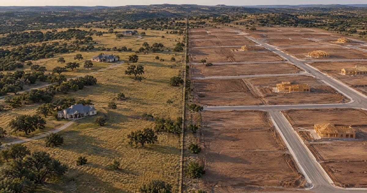
Shoreline Ranch Texas LP owns 130 parcels covering 540.96 acres inside city limits, according to county appraisal records.6 The ranch's zoning allows up to 568 homes.7 Tier 1 guides land to no more than 0.33 homes an acre, on lots of at least 3 acres. Tier 3 guides land to about 1.0 home an acre, on lots of at least 1 acre.8
What we reported before
Our earlier story, Lago Vista land use map has had eight versions since 2016, reported a July 9 commission vote of 4 to 1.9 That vote based the map on one marked up by commissioners Gene Harris and Dave Stewart.91011 It reported that Kevin Sullivan, a former mayor, told the commission in August that "Shoreline Ranch representatives have engaged me."1213
It also reported that the city's water and wastewater master plans list $244.2 million in capital projects.1415 And it reported that the plan's consultant, Halff Associates, had a $240,000 contract, with the first $200,000 budgeted in the General Fund.161718
Before the meeting
The Oct. 1 agenda asked the council to act on the commission's recommendation and to give staff direction on the next draft.5 Development Services Supervisor Tam Pieklik submitted the staff report. Staff noted that the marked-up map placed no land in Rural Residential Tier 3.4
Staff asked the council for direction on five points. The first two were the 11-place-type framework and the revised map with its labels. The third asked whether the council wanted any direction on Rural Residential Tier 3. The last two were any other revisions and whether staff should go ahead with the next draft, the supporting maps, and any required public hearing.4
Three more maps, for roads, evacuation, and utilities, were still being drawn. Staff said those maps depend in part on council direction on the FLUM.4
Public comment
The mayor opened Item VIII.3, the land use map item, at the council's regular meeting in the City Council Chambers.519 He went straight to citizen comments, because no staff presentation was given.19
Sullivan spoke first, saying he was "representing Shoreline Ranch," and asked for the Neighborhood Residential label.19
Sullivan said the owners have "held rights to build out" a master plan community since 2007. He called those rights entitlements, "the different unit types that we had as part of our approved PDD." A planned development district (PDD), he said, is "much more detail oriented," covering "setbacks, lot sizes, those kinds of things."19
Sullivan said the Neighborhood Residential label would give the owner only "the opportunity to ask" for changes. He also said Tier 1 "restricts what kinds of future PDD amendments Shoreline Ranch may even ask the city to consider." He said the owners want to bring "a modern market driven development plan that can be evaluated on its merits."19
A second speaker said, "We are the developers of Shoreline Ranch and the owners." He said a city consultant told him the ranch would be shown as Neighborhood Residential.19
Enrique Lopez, a commission member who cast the lone vote against the July recommendation, spoke third.919 He said that if the map comes back to the commission, he would "promote and vote for the change."19
The mayor later called on "Mr. Dave Stewart," one of the two commissioners who marked up the map.1019 Stewart said "the P&Z did vote and recommend" the map to the council.19
Stewart said Turnback Ranch "should be a neighborhood residential a 1 to 4."19 Turnback Ranch is a planned development district on Bar-K Ranch Road that a 2025 staff table lists at 349 homes.7 Neighborhood Residential guides land to 1 to 4 homes an acre.8 On "the peninsula," he said, the city "had previously zoned that floodplain as a park."19
Stewart asked that the 18 acres "be kept as a park." On Shoreline Ranch, he said, "the way that we zoned it is correct."19
Most other speakers urged the council to keep the commission's map. Another speaker said he supports the commission's framework "including retaining rural residential Tier 1." He said that if an investment depends on favorable changes, "that is the purchaser's business risk."19
A resident who bought land near the ranch asked who will pay for schools, water, sewer, safety, and roads. A land developer from the metro area said, "I support what you're doing on the new map, but keep Shoreline Ranch where it is."19
The mayor then read written comments into the record. He said the written comments he summarized all supported the commission's map and "keeping shoreline as rural residential." One writer, who wrote of serving on the commission, urged the council to "postpone consideration." The letter said the first action item on the agenda showed the city's need for funds "to maintain aging infrastructure."20
That first item asked the council to ratify emergency repairs to the wastewater treatment plant's lift station discharge piping, which our lift station story covers.5 Another letter said the draft moved Turnback Ranch from four homes an acre to eight, and asked that it stay at "one to four units per acre." One more writer asked the council to "retain P&Z's recommended rural residential tier one designation for Shoreline Ranch."20
Council discussion
Council Member Paul Prince opened the discussion by saying he had been the council's liaison to the commission. He said the commission spent little thought on commercial land. He said, "I think that this map should not be approved today."21
A speaker not identified on video asked whether staff and the council could take a first pass at commercial land before sending it back to the commission. Prince said that approach might be better.21 Mayor Pro Tem Norma Owen, who fills in for the mayor, said, "I think that we need some conversation around economic development."22
Council Member Jess Hall, joining by video link, said the map "doesn't take away any entitlements that landowners have." He said he applauded "taking another look at commercial." He said he did not know the total of the city's approved commitments for water and wastewater service. He asked about "what the cost of that will be for these commitments."23
The mayor said, "I think we have consensus" that staff and council should look at commercial areas. He then called on Council Member Karen Van Ness, who named two corrections to explore.24
Turnback Ranch, she said, appeared to be color-coded wrong and should be Neighborhood Residential to match what the city had negotiated. On the peninsula, she said, 18 acres are zoned as park. She asked whether the city could "retain that park designation." She said, "let's explore those two and get the facts on them."24
Prince then turned to the rural tiers. He said land that used to be marked one acre had moved to two acres, and asked if that was consistent. He called one change to land outside the city limits "a pretty big change for lower density."25
Police Chief Ron Joy said staff chose Freese and Nichols to provide a development services director and planning help.2627 He said a contract should reach the city "next week." The mayor asked whether he should call a special meeting for council to "get together and get some big maps."26 Under the council's rules of procedure, the mayor may call special meetings.28
Council Member Adam Benefield cited the crowd and "50 letters" and said, "it is game time." The mayor answered that if anything was left undecided, he would prefer that "we have a special call meeting and we hammer it out." Van Ness then said, "I am in agreement with keeping rural residential tier one."29
Benefield said "we paid a firm $250,000" for the map.29 The council's 2023 records show a $240,000 contract, which also covered a park master plan.1718
Benefield said he would explain his reasons before making a motion. He said the problem for a buyer is that "what's not on the map is this PDD." He said nothing that day addressed wastewater capacity, water capacity, roads or infrastructure, and "None of those things are being considered tonight." He said Shoreline Ranch's owner "can build 568 homes whether we like it or not."30
Benefield said what the council can control is whether more people "unknowingly buy a piece of property" expecting rural neighbors. City Attorney Brad Bullock, whom he asked, said a map "is not a regulatory land use tool. It is a vision for the future." Benefield said, "What I want is transparency."30
Benefield said an ordinance "requires six council members to approve any amendment to a PDD." He said an owner seeking more homes would have to convince "six of us." He cited an ordinance number we could not confirm.30 The 2023 ordinance in this story covers changes to the Comprehensive Plan, not to a PDD.31
He cited Senate Bill 15, which he said "limits municipal residential lot size and density requirements," and Senate Bill 840, which he said "applies to larger municipalities." He said, "Now this doesn't apply to us," but that owners "sue, right? Or they go and advocate to the state legislator." He said the talk could then move from 568 homes to "3,000." We did not check those laws for this story.30
He said, "you make the map reflective of his entitlements." He said the gap between the ranch's entitlements and five-acre lots is "massive."30 Tier 1 guides land to lots of at least 3 acres.8
Benefield then moved to designate Shoreline Ranch as Neighborhood Residential. He said that followed the recommendation of "our Development Services Director Jordan."32 The July 9 commission minutes list Jordan Strohmeyer as staff liaison.9 Our earlier story reported that a Halff draft plan dated March 25, 2025, shaded Shoreline Ranch in its Rural Residential color.33
The mayor asked for a second, saw none, and said "the motion fails."32
Prince said, "maybe I misread it," but put the ranch's entitlement at about one unit per acre "at a gross level across the property." He said that density "aligns with the residential tier three of one acre minimum." Prince said "the big concern" he heard from citizens was that the map could be "a backdoor" to "2,000 plus units." He suggested Tier 3, which he said "meets the density level of their current entitlements."34
Van Ness said, "I'm not supportive of reducing that from rural residential tier one." She said, "this is a vision document for the city." She said she did not think "a single developer should be driving what we're doing."35 Prince then recommended a commercial strategy plan done "as a single council special called session."36
The mayor's motion
Saum said the people who came and wrote in "deserve to at least hear the motion that you wanted." He then moved to approve the commission's draft map, correcting the Turnback Ranch designation and the park designation near the peninsula. The motion designated Shoreline Ranch Rural Residential Tier 1 "with a prominent disclaimer" printed on the map stating "this does not reflect entitlements." It also called for "a special called meeting for council to reassess commercial zoning."1
The mayor asked for a second and said, "I have a second from the Mayor Pro Tem." The motion did not name a new label for Turnback Ranch, and for the peninsula it said only "correcting the park designation."1 Our reading is that the two corrections match the points raised earlier, Turnback Ranch to Neighborhood Residential and the peninsula's 18 acres kept as park.124
Benefield said, "I'm going to vote no on it." He said he appreciated the disclaimer, which he said helps future residents understand the map. He said of Prince's idea, "I actually like your proposal much better."37
Council Member Amanda Chavarria said, "Mayor, I'm also going to be a no on this." She said she would "support everything except for the rural residential tier one." She said she would be in favor if the motion had used Tier 3, "as Mr. Prince had suggested."38
Owen said she "wholeheartedly" felt the council "should stay with the motion that you stated." She also said the council has "some process issues within our ordinances that we need to look at carefully."39 Then the mayor asked for ayes and nays and announced, "It's approved five to two."2
How they voted
The voting members were Mayor Shane R. Saum, Mayor Pro Tem Norma Owen, and Council Members Amanda Chavarria, Jess Hall, Adam Benefield, Karen Van Ness, and Paul Prince.5 The city had posted no minutes by Oct. 2, so we cannot confirm any member's vote.3 The video shows the mayor announcing the result as five to two on a voice vote.2
Before the vote, Benefield and Chavarria each said they would vote no.3738 Benefield's earlier motion got no second, so the council did not vote on it.32
| Member | Vote | What the member said on video |
|---|---|---|
| Mayor Shane R. Saum | Unconfirmed, minutes not posted | Made the motion |
| Mayor Pro Tem Norma Owen | Unconfirmed, minutes not posted | Said the council should stay with the motion |
| Council Member Amanda Chavarria | Unconfirmed, minutes not posted | Said she would vote no |
| Council Member Jess Hall | Unconfirmed, minutes not posted | Said the map takes away no entitlements |
| Council Member Adam Benefield | Unconfirmed, minutes not posted | Said he would vote no |
| Council Member Karen Van Ness | Unconfirmed, minutes not posted | Said she does not support reducing Tier 1 |
| Council Member Paul Prince | Unconfirmed, minutes not posted | Suggested Tier 3 |
What it means for you
The staff report has sections for background, findings, and attachments, and no financial impact line.4 The motion as stated sets no tax, fee, or rate.1
Benefield said the ranch's entitlements "are entitlements that they have regardless."30 The label could affect later zoning requests for the ranch.31
Under a 2023 ordinance, a later zoning request that does not fit the Tier 1 label would first need a plan amendment.31 That takes "at least three-fourths" of all council members, or at least six of seven votes.531 City Attorney Brad Bullock said the city's ordinances also "have a provision that allows for variance from that."30
The utility map will identify "infrastructure and transmission needs necessary to support anticipated development and land uses." The staff report describes that map in words only and names no dollar figure for it.4 Hall asked what the water and wastewater capacity for approved developments would cost.23
On costs, the comments pulled two ways.1920 A resident asked who will pay for roads, water, and sewer.19 One letter said a city needs a strong "ad valorem and sales tax base," meaning property and sales taxes.20
The motion gave no date for the special called meeting.1 The staff report asks about a public hearing but gives no date for one.4
Where it stands
The motion calls for a special called meeting for council to reassess commercial zoning.1 Staff had asked whether to prepare the next draft and any required public hearing. The roads, evacuation, and utility maps still depend in part on council direction on the FLUM.4
How to weigh in
Speaking at citizen comments requires a completed form, in person or by email. The council meets in the City Council Chambers.5 You can file a records request on the city's page, and the city has up to ten business days to respond. City Hall's phone number is 512-267-1155.40
What we could not find
- The minutes, with each member's vote, the mover, and the seconder.3
- The date of the special called meeting on commercial zoning.1
- The full text of the map's disclaimer, beyond the motion's words "this does not reflect entitlements."1
- The Freese and Nichols contract and its price.26
- The total the city has paid Halff, which our earlier story also could not find.17 Benefield said "we paid a firm $250,000," but the corrected 2023 contract of $240,000 also covered a park master plan.1729
- The final price of the council's 2024 Halff add-on. The Sept. 5, 2024 motion set no price.41 Halff's price list put an extra advisory committee meeting at $6,500 and more plan revisions at $4,200.42
- How the packet measures "gross" density, since its table labels density "du/ac, gross" (homes per acre) and does not define the term.8
- Who asked to put Item VIII.3 on the agenda, since the staff report names only who submitted it, Tam Pieklik.4
What you can do
- Check the city's meeting portal for the Oct. 1 minutes.3
- File a Texas Public Information Act request on the city's records request page for the Freese and Nichols contract and its price. The city's page says Texas Government Code, Chapter 552, gives you the right to access government records.40
- Ask in the same way for Halff Associates invoices and payments for the plan work.40
- Speak at citizen comments at a council meeting after submitting the form.5
If you have records on this, you can share them with us at /share-records. We protect your identity and publish the evidence when we can do so safely.
Email alerts
Get the next story by email
We email you when a person has checked a new story against the record and it goes live. No ads, no tracking.
Podcast transcript
Read the transcript
Host 1. This is the Lago Vista Watchdog briefing. The two voices you are hearing are AI generated. Every fact in this episode is sourced in the full story on our website, and a person validates each story before it is published.
Host 2. Here is the bottom line. On October 1, 2026, the Lago Vista City Council approved a draft land use map that labels Shoreline Ranch Rural Residential Tier 1. Mayor Shane Saum announced the voice vote as five to two, the meeting video shows. The city had posted no minutes by October 2, so every member's vote is unconfirmed.
Host 1. For taxpayers, the staff report lists no cost, and the motion set no tax, fee, or rate. Staff say a utility map now being drawn will be coordinated with this map.
Host 2. Some background. The Future Land Use Map is part of the city's Comprehensive Plan, a long-range policy guide in the words of the staff report. Staff say it does not rezone property. It gives each area one of 11 place types, and the council decides it on a recommendation from the Planning and Zoning Commission.
Host 1. Shoreline Ranch Texas LP owns 130 parcels covering 540.96 acres inside city limits, according to county appraisal records. The ranch's zoning allows up to 568 homes. Tier 1 guides land to no more than 0.33 homes an acre, on lots of at least 3 acres. Tier 3 guides land to about one home an acre, on lots of at least 1 acre.
Host 2. We covered this map before. Our earlier story reported that the commission voted 4 to 1 in July to base the map on one marked up by commissioners Gene Harris and Dave Stewart. It reported that former Mayor Kevin Sullivan told the commission in August that Shoreline Ranch representatives had engaged him. It also reported 244.2 million dollars in water and wastewater capital plans, and a 240,000 dollar contract with the consultant Halff Associates.
Host 1. Now, what is new. The October 1 staff report noted that the marked-up map placed no land in Tier 3. Staff asked the council for direction on five points, including Tier 3 and whether to prepare the next draft and any public hearing.
Host 2. At the meeting, the mayor went straight to citizen comments. Sullivan spoke first, representing Shoreline Ranch, and asked for the Neighborhood Residential label. He said that label would give the owner only "the opportunity to ask" for changes.
Host 1. Enrique Lopez, the commission member who cast the lone vote against the July recommendation, said that if the map comes back, he will promote and vote for the change. Then Dave Stewart, one of the two commissioners who marked up the map, said the commission voted to recommend it. He said Turnback Ranch should be Neighborhood Residential, and asked that 18 acres on the peninsula be kept as a park. On Shoreline Ranch, he said, "the way that we zoned it is correct."
Host 2. Most other speakers urged the council to keep the commission's map. One said that if an investment depends on favorable changes, "that is the purchaser's business risk." A resident who bought land near the ranch asked who will pay for schools, water, sewer, safety, and roads. The mayor read written comments and said the ones he summarized all supported the commission's map.
Host 1. In council discussion, Council Member Paul Prince said the commission spent little thought on commercial land. Council Member Jess Hall, joining by video link, said the map "doesn't take away any entitlements that landowners have." Hall asked what the city's approved water and wastewater commitments will cost.
Host 2. The mayor said, "I think we have consensus" that staff and council should look at commercial areas. Council Member Karen Van Ness named two corrections to explore, for Turnback Ranch and for park land on the peninsula.
Host 1. Police Chief Ron Joy said staff chose the firm Freese and Nichols to provide a development services director and planning help, and that a contract should reach the city next week.
Host 2. Council Member Adam Benefield cited the crowd and the letters and said, "it is game time." He said the city paid a firm 250,000 dollars for the map, while the council's 2023 records show a 240,000 dollar contract that also covered a park master plan. He said the ranch's owner "can build 568 homes whether we like it or not." City Attorney Brad Bullock, whom he asked, said the map "is not a regulatory land use tool. It is a vision for the future."
Host 1. Benefield then moved to label Shoreline Ranch Neighborhood Residential. No one seconded it, and the mayor said the motion fails.
Host 2. Prince suggested Tier 3 instead. He said it "meets the density level of their current entitlements." Van Ness said she was not supportive of reducing the ranch from Tier 1. She said she did not think "a single developer should be driving what we're doing."
Host 1. Then the mayor made his motion. It approved the commission's draft map with corrections for Turnback Ranch and the peninsula park designation. It labeled Shoreline Ranch Tier 1 with a disclaimer on the map stating "this does not reflect entitlements," and called for a special called meeting to reassess commercial zoning. The mayor said the second came from the Mayor Pro Tem.
Host 2. Benefield said he would vote no. Council Member Amanda Chavarria said she would also be a no, and would be in favor if the motion had used Tier 3. Mayor Pro Tem Norma Owen said the council should stay with the motion. The mayor then called the voice vote and announced, "It's approved five to two."
Host 1. What it means for you. Under a 2023 ordinance, a later zoning request that does not fit the Tier 1 label would first need a plan amendment, and that takes at least six of seven votes, by our math. Bullock said the city's ordinances also have a provision that allows for a variance. The staff report names no dollar figure for the utility map. On costs, the comments pulled two ways. A resident asked who will pay for roads, water, and sewer, while one letter said a city needs a strong base of property and sales taxes.
Host 2. Some records are still missing. The city has not posted the minutes. We also could not find the date of the special called meeting, the Freese and Nichols contract and its price, or the total the city has paid Halff.
Host 1. You can file a Texas Public Information Act request on the city's records page for that contract and for the Halff invoices. The city has up to ten business days to respond. You can also speak at citizen comments by filling out the form.
Host 2. The full story, with every source, the meeting clips, and our earlier coverage of the map, is at lagovistawatchdog.com. Thanks for listening.
Sources and documents
Every fact in this story comes from the records below. The small numbers in the story point to them. Links go to the exact moment in the meeting video or the page in the document.
- City Council meeting video, October 1, 2026, the mayor's motion and second At 2:33:39.
- City Council meeting video, October 1, 2026, the vote on Item VIII.3 At 2:37:48.
- City of Lago Vista meeting portal, list of meetings with agendas and minutes
- City Council agenda packet, October 1, 2026, Item VIII.3 staff report on the Comprehensive Plan and FLUM See p. 38.
- City Council agenda, October 1, 2026, Item VIII.3
- Travis Central Appraisal District, 2026 property records for owner Shoreline Ranch Texas LP (owner ID 1921198), 130 parcels
- City Council agenda packet, April 17, 2025, staff table of potentially dormant entitlements See p. 402.
- City Council agenda packet, October 1, 2026, Future Land Use place types table and descriptions See p. 41.
- Planning and Zoning Commission agenda packet, August 13, 2026, draft minutes of July 9, 2026 See p. 10.
- City of Lago Vista council forum, "FLUM Maps (Comp Plan)," Planning & Zoning Commission section, February to April 2026
- Planning and Zoning Commission amended agenda, August 13, 2026
- Planning and Zoning Commission meeting video, August 13, 2026, Kevin Sullivan citizen comment At 0:02:23.
- City Council minutes, October 16, 2025 See p. 1.
- City Council agenda packet, March 6, 2025, Resolution No. 25-2120 and final Water Master Plan See p. 98.
- City Council agenda packet, April 18, 2024, Wastewater Master Plan executive summary See p. 91.
- City Council agenda packet, July 6, 2023, Halff Associates comprehensive plan contract See p. 140.
- City Council agenda packet, December 7, 2023, Halff Associates agreement amendment See p. 18.
- City Council minutes, December 7, 2023 See p. 4.
- City Council meeting video, October 1, 2026, public comments on the land use map At 0:28:40.
- City Council meeting video, October 1, 2026, written comments read into the record At 1:34:04.
- City Council meeting video, October 1, 2026, Council Member Prince opens discussion At 1:43:23.
- City Council meeting video, October 1, 2026, Mayor Pro Tem Owen on the map At 1:54:29.
- City Council meeting video, October 1, 2026, Council Member Hall on the map At 1:58:15.
- City Council meeting video, October 1, 2026, consensus on commercial areas and two corrections At 2:00:58.
- City Council meeting video, October 1, 2026, Council Member Prince on the rural tiers At 2:02:32.
- City Council meeting video, October 1, 2026, new planning and engineering services At 2:09:37.
- City Council agenda packet, October 1, 2026, Item IX.1 staff report See p. 63.
- City Council agenda packet, June 18, 2026, Ordinance No. 26-05-07-04, Rules of Procedure See p. 286.
- City Council meeting video, October 1, 2026, Council Member Benefield on making a decision At 2:11:35.
- City Council meeting video, October 1, 2026, Council Member Benefield's reasons for his motion At 2:16:57.
- City Council agenda packet, January 19, 2023, Ordinance No. 23-01-19-03 See p. 123.
- City Council meeting video, October 1, 2026, Council Member Benefield's motion At 2:27:29.
- Draft 2025 Lago Vista Comprehensive Plan and Parks Master Plan, dated March 25, 2025, Future Land Use Map See p. 33.
- City Council meeting video, October 1, 2026, Council Member Prince on Rural Residential Tier 3 At 2:28:26.
- City Council meeting video, October 1, 2026, Council Member Van Ness on the map At 2:30:48.
- City Council meeting video, October 1, 2026, Council Member Prince on a commercial plan At 2:32:34.
- City Council meeting video, October 1, 2026, Council Member Benefield explains his no vote At 2:34:29.
- City Council meeting video, October 1, 2026, Council Member Chavarria explains her no vote At 2:35:33.
- City Council meeting video, October 1, 2026, Mayor Pro Tem Owen explains her vote At 2:35:46.
- City of Lago Vista, Open Records Request page
- City Council minutes, September 5, 2024 See p. 4.
- City Council agenda packet, September 5, 2024, Halff additional services See p. 137.
See something wrong? Request a correction. Have records on this? Share them with us.